Updated on September 15, 2011
Mt. Whitney? Check.
It’s been nearly a month since me and Scott were standing on top of Mt. Whitney, the tallest peak in the continental United States. It was satisfying on so many levels. My two (only two!) blisters are finally nearly healed. That one mushed toenail never fell off. My back didn’t go out on me. I trained and trained for this and we made it to 14,505 feet without any problems, but that’s not to say the three-day trip wasn’t an adventure or a walk in the park.
The first day was spent driving up Hwy 120 to Yosemite and Tioga Pass where we lucked into (maybe) the last cabin available at the Tioga Pass Resort, which sits around 10,000 feet. We didn’t have a reservation anywhere and were hopeful to stay somewhere above 9,000 feet so we could begin to acclimate. After failing to get a tent cabin at Tuolomne Meadows in Yosemite, we just hoped to camp somewhere in the area or, best case, get a room at the resort. We did, thankfully, and took a quick 2 mile hike up to an old silver mining ghost town called Bennettville near some pristine and otherwise remote lakes, set against a magnificent backdrop of snow-covered peaks.
That night was crucial to the trip’s success, I think, as that afternoon I started to develop a dull headache and eventually had a really crappy night’s sleep (maybe due to the amazing berry crumble and ice cream at the resort restaurant?). Both are symptoms of altitude sickness – something I was hoping to avoid, for obvious reasons. It never got any worse than tossing and turning that night so I ignored it, popped some Advil, and we set out for Lone Pine after a quick shower and good breakfast that morning.
Earlier in the year, Scott had applied for and secured a permit for one day on the mountain inside the Whitney Zone (map – PDF), thus giving us a day to make the summit. But we were hopeful that the recent bad weather might scare some other permit holders away and give us a shot at a second day’s permit. So after a four hour drive on Hwy 395 we checked into the Eastern Sierra Interagency Visitor Center prior to 11am and got into the daily lottery. Scott drew a nasty 17 out of the hat (out of about 20), but the ranger said most existing permit holders would get the extra permits they wanted. Lucky enough, we did, and we were stoked to set off for the trailhead after a quick sandwich stop at Subway, and to grab some last-minute food rations at the local grocery store. We were planning to travel as light as possible, not taking a stove or utensils so we planned to load up our single bear canister with trail mix, fig newtons, crackers, peanut butter, energy bars and goo, electrolytes, and the like.
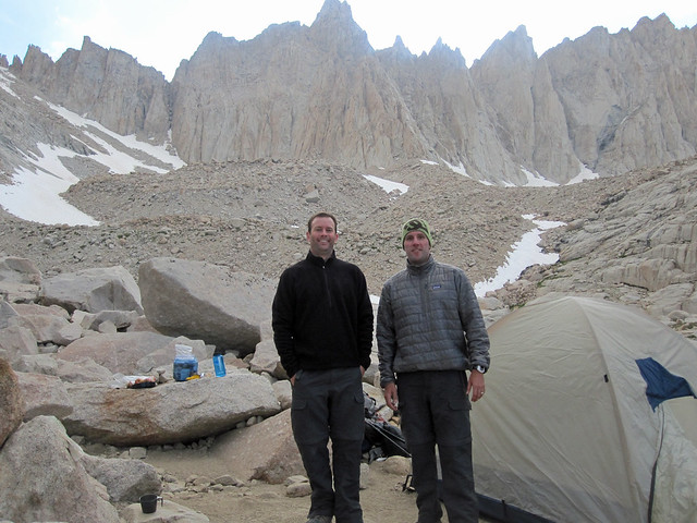
 Some old school Metallica got us up the road to the Whitney Portal, where we scored a great parking spot and spent an hour getting ready, stripping our gear down and packing only the essentials. We weighed in at the trail scales – Scott was the man at 40 lbs. (thanks to the bear canister) and I was packing 35. So at about 1pm we set out from approx. 8,600 feet. About four hours and over 3,000 feet later, up countless granite steps and switchbacks, we made it to trail camp well above the timberline, at about 12,000 feet.
It’s funny that people complain about the notorious 97 + switchbacks, which lead from trail camp to the John Muir Trail at the trail crest, or the stretch that runs along the ridgeline leading up to the summit. Sure, these switchbacks are a bitch. But the whole 11 miles from the portal are nothing but switchbacks. The trail is incredibly well kept, especially considering all the nasty weather this year and flash floods two weeks earlier. But the trail is short and steep, and goes back-and-forth practically the entire way up to the crest. I didn’t realize how brutal this was until we were on the way down, however. More on that in a sec.
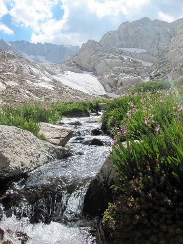
The switchbacks were all free of snow, but it was cold that night/morning at trail camp with temps dropping into the low 30s. Some ice remained in the shady spots on the trail but nothing treacherous. We packed only essentials for the summit that day, filled up and UV cured 8 liters of water between the two of us, and at 6:30am started going up and up and up. Despite the grueling switchbacks and continuous steps (they are indeed tough as you push up over 13,000 feet), it was exciting to ascend up the sheer face of the mountain, gorgeous views in all directions, water flowing over portions of the trail from the snowmelt, and gigantic peaks ahead. We could catch glimpses of the summit, which seemed to get further away the closer we got to it.
This was especially true as we cleared trail crest, where we began to meet some interesting folks who had spent a month or so on the Muir trail. Whitney serves as the final landmark on the Muir trail so you get some scruffy characters who’ve been in the wilderness for weeks. They’re amped to be there and finishing their journeys, and meeting these happy folks gave me a boost to finish the climb. I was now feeling like we were getting close, but still had a long way to go, plus another final ascent to get there. It just. Seemed. So. Far. Away. Feeling good, we trudged on.
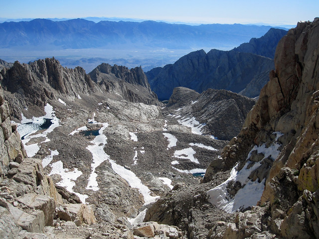
The trail along the ridgeline behind these great granite spires gets hairy in some spots, with crumbled chunks of rock obviously just peeling away from the cliffs above, from the spires that seem to be as tall as the summit itself. I had heard a couple of distant rock falls during the previous restless night spent in the tent. There’s nothing but granite rubble everywhere up there – the mountain must be constantly in motion. Along the ridge, with impossible views to the west and east, you start to wonder how amazing it’d be to climb up the rocky spikes above, while thinking about how shitty it’d be to slip off the left edge and go careening down to the west, a virtual stone abyss off the ledge. The so-called “windows” between the spires offer some incredible views to the east and other incredible vertical drops. As we passed, I wondered if anyone had ever BASE jumped from these spots. You think it’d be fun to descend by parachute, if not for the thrill but also because then you wouldn’t have to walk all the way back down those countless steps and goddamned switchbacks.
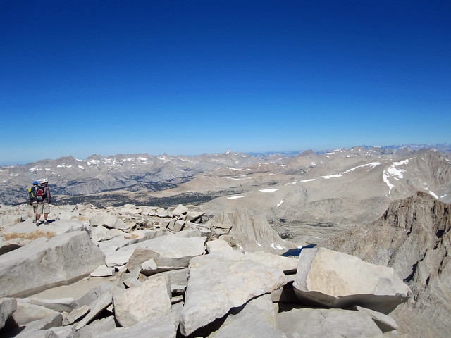
We trudged on to the summit, over a somewhat sketchy snowfield which was cut at about a 45 degree angle into the edge of the mountain. The summit lay just ahead, up and to the right, but about another 500 vertical feet and a long half mile away. Stopping every 50 feet or so for a breath and a sip of water, we eventually made it to the top to the rock cabin (an old Smithsonian research station) and the granite slabs that somehow stay put, dangling over the top. It took about 4 hours from trail camp – we stood on the summit at about 10:40am. We caught a guitar show from a guy who called himself The Boot-Stompin’ Dave Thompson, met some other hikers including a rude know-it-all and the crazies who had done the whole hike in a day. One woman, an avid trail runner, bolted down and ran the whole way down.
 That could have been us doing the day hike with our single-day permit, but I’m really glad it wasn’t. It was hard enough to do as an overnighter. Starting the trail at 3am and doing all 22 miles in a day would have just been brutal. I’d like to think from a fitness standpoint we could have done it, but on the way down… down… down the steps and switchbacks I was thankful that we spent the night on the mountain. As you’re going down, the steps aren’t just nice stair steps. They’re steps down big and small rocks, onto sometimes jagged, triangular pieces of granite that serve as the best footing possible. You’re trying to move quickly so as just to get down. And it takes an incredible amount of concentration, which gets tiring. There wasn’t much conversation on the lower half of the trail. Twisting an ankle or knee would be all too easy. So you’re careful with each quick step because at 20 miles you just want to finish. Plus, it’s just jarring, especially carrying 30 lbs. or so down, each step starts to feel crushing after just a few miles of descent.
Anyway, we made it back to the car at about 5pm, exhausted but happy we had made the trek. Next stop, our motel room in Lone Pine for a much-needed shower. We later wolfed down a pizza and Sierra Nevadas at a local joint. Slept like a baby that night, and drove the whole way home the next day.
Whitney? Check. Three days, 22 miles, and about 6,000 vertical feet up (and another 6,000 down).
People ask now: Does it feel like something’s missing since you’ve done it? Yeah, it does. After months of training and prepping and planning and thinking about it, to have it finished leaves you feeling a little empty. I’m not clamoring to go climb Everest, but I hope to stay active. I’ve been eating and drinking more, and exercising generally less, but still feel in OK shape. Though, that emptiness doesn’t compare with the feeling of having checked Whitney off the list. This trip was 15 years in the making since my first failed attempt, so it was all worth it.
I’m also lucky to have an understanding wife and kids who allowed me the chance to do it. I couldn’t have without their support (or tolerance!). My son appreciated the gift I brought back for him. He asked me if I’ll do it again someday. I told him: Only if you go with me.
Random factoids:
- Months training: 9+ (including PT for the back)
- Miles hiked on Whitney: 22
- Months of serious training hikes: 4
- Miles hiked on Mt. Diablo: ~24
- Miles hiked on other Bay Area trails: 35+
- Miles swam as part of rehab & training: too many
- Hours spent stretching during rehab/training: 1 hour/day x 6 days/week x 9 months. Do the math.
- Clif Bars consumed on Whitney: 4
- Liters of water consumed on the trek: 12+
Critical gear:
- REI Flash 50L pack
- Solomon Quest 4D GTX boots (but a little disappointed my feet were so mashed at the end)
- REI Traverse trekking poles
- Patagonia bucket hat
- Patagonia micro puff jacket
- REI silk sock liners and Bridgewool lightweight hiking socks
- 2L Camelbak reservoir
- 2×1 liter Nalgene bottles
- Nuun flavored electrolyte water tablets
- Jelly Belly Sport Beans (they’re awesome!)


Congratulations on the accomplishment — great write up! I’ve done a lot of hiking at high elevations when I lived in Colorado and it’s amazing how hard it can be just to take a step when you’re oxygen depraved… so impressed your accomplishment. And you lugged 8L of water… that’s like 18lbs! Nice work!
Awesome, Steve — just awesome. And nicely related, too.
Pingback: Back in the game, again – Endopolis